Earth Camera Live Street View
- 3.0
- Rating
- 10.00M
- Installs
- Free
- Price
 Analysis by App-foxy
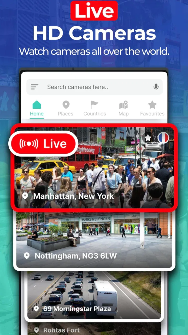
I spent time with Earth Camera: Satellite View to see whether it is useful as a navigation and visual-exploration app or mainly an attractive way to look at places. Its store summary presents it as a tool for GPS navigation and live street viewing, while the short description calls it “Earth Camera.” That combination sets a fairly specific expectation: this is not simply a standard route planner, but an app built around viewing the world through map and camera-style imagery.
My overall impression is mixed but practical. The app can be interesting when I want a quick visual sense of a location, a broad look at a destination, or a more immersive alternative to a conventional map screen. At the same time, I would not treat it as my only navigation tool for an unfamiliar journey. The experience is more enjoyable when I approach it as a visual map companion rather than as a complete replacement for the navigation apps most people already use.
What Earth Camera: Satellite View actually offers
This is a free Maps & Navigation app from Easy Language Translator. It has reached over ten million installs and carries an Everyone content rating, so it is clearly aimed at a broad audience rather than a specialist group of travelers or professional drivers. The current version is 5.1.1, and it runs on Android 8.0 or later.
You May Also Like

 Pandora - Music & Podcasts
Pandora’s Music Is Easy to Start, but Harder to Recover
Pandora’s strength is its low-effort path from a seed to a station. Its weak spot is how much confidence it asks you to place in connection, setup, and quiet recovery.

 AccuWeather: Weather Radar
AccuWeather Review: A Quick, Clear Forecast for Everyday Decisions
For everyday plans, the best forecast is the one you can understand quickly. AccuWeather makes rain timing, radar, and local conditions easy to act on, with a few trade-offs.

 Hill Climb Racing
Why Hill Climb Racing Still Turns Crashes Into One More Run
A tiny car, a bumpy hill and one more upgrade: Hill Climb Racing keeps resurfacing because its simple chaos makes every near-miss feel personal.

 AliExpress - Shopping App
AliExpress Makes Global Shopping Feel Personal, but Shoppers Bear the Risk
AliExpress turns a global marketplace into a pocket-sized discovery engine. Its reach is useful, its shopping loop compelling, and its trade-offs easy to miss.

 Lords Mobile: Kingdom Wars
Lords Mobile Is a Kingdom-Building Routine, Not a Quick Match
A case-by-case verdict on the building, battles, device demands, and social commitments that make Lords Mobile rewarding for some players and exhausting for others.

 PDF Scanner app - TapScanner
TapScanner Makes Paperwork Easier to Capture, Check, and Share
TapScanner makes scanning with a phone feel less like a rescue operation and more like a dependable step in getting work done. Its capture tools are useful, though not flawless.
More From Our News Desk
View All News


Those details matter because the app is easy to approach. I do not need a modern flagship phone or a specialist interest in cartography to understand its purpose. The main appeal is visual: I can use a map-based view to inspect places, switch my attention from route lines to the surrounding environment, and explore locations that I may be planning to visit.
The name “Satellite View” can create a very high expectation, especially for anyone who has used mature mapping platforms with extensive layers, business information, traffic data, transit planning, and carefully maintained street imagery. In practice, I found it better to think of this app as a focused viewing experience. It gives the map a more visual character, but that does not automatically make it a full-featured alternative to every established navigation service.
The app’s popularity is notable, although its average rating is 3.1 from roughly twenty-seven thousand ratings. I read that combination as a warning to keep expectations measured. A large install base shows that the concept attracts people, but the rating suggests that the experience does not satisfy everyone equally. For me, that makes the details of the intended use more important than the download count.
How I used it in ordinary situations
One realistic use is preparing for a visit to a place I have never seen. Before leaving, I can look at the area around a hotel, a landmark, or a meeting point and build a rough mental picture of the surroundings. That is useful when a normal road map feels too abstract. Seeing the layout of nearby roads and the shape of the area can make an unfamiliar destination feel less intimidating.
I also found value in using it as a casual exploration tool. If I am curious about a coastline, a large park, or a distant neighborhood, the visual presentation gives me a reason to browse without entering a precise destination first. This is different from opening a navigation app only when I already know where I want to go. Earth Camera: Satellite View encourages looking around and forming a sense of place.
Another practical workflow is checking a location before choosing how to approach it. I might compare the position of a building with surrounding roads, open spaces, or nearby landmarks, then use a conventional navigation app for the actual turn-by-turn journey. That two-app approach is more sensible than expecting one application to do everything equally well.
The strongest use of this app is visual orientation before navigation, not blind reliance during a complicated trip. That distinction prevents most disappointment. It also explains why someone may enjoy the app even if they already have a preferred route planner installed.
What the free access means for value
Earth Camera: Satellite View is free to install, which makes trying it low risk. I can explore the basic experience before deciding whether it deserves space on my phone. The app also contains in-app purchases ranging from $9.99 to $39.99 per item. Because those purchases are optional rather than part of the stated download price, the sensible starting point is to judge the free access on its own.
That free entry is valuable for occasional users. If I only want to inspect a destination once in a while, preview an area before a trip, or enjoy a satellite-style map without committing to a subscription, there is a clear advantage in being able to start without paying. I would not pay simply because the app has a large install base; I would first confirm that its free experience fits my own routine.
The paid side requires more caution. A purchase can be worthwhile only if it removes a limitation that genuinely affects the way I use the app. Someone who opens it every week for location planning may see more value than someone who downloads it out of curiosity and forgets about it. Since the purchase range is broad, I would inspect the exact item and its purpose inside the app before spending money.
In other words, the free version is the trial and the paid options are a personal calculation. I would not describe the app as automatically good value at the upper end of that range. The cost may make sense for a committed user, but casual exploration does not justify paying by itself.
Where it feels useful compared with regular map apps
Most familiar navigation apps are designed around an immediate question: how do I get from here to there? Their priorities are routes, addresses, travel time, traffic, businesses, and spoken guidance. Earth Camera: Satellite View approaches the map from another direction. Its appeal is the visual relationship between a place and its surroundings.
That difference is important when I am still deciding what I want to do. A route planner can tell me how to reach a destination, but a satellite-style view can help me understand the area before I commit to a route. It is particularly useful for forming a broad picture of a location rather than following a sequence of instructions.
It can also be more engaging for people who enjoy geographic browsing. I like being able to inspect a place without turning the task into a strict journey. This gives the app a small discovery element that a conventional navigation screen does not always provide.
However, regular map services remain the better choice when I need dependable, detailed travel assistance. If my priority is live traffic, public transport planning, business hours, saved places, or highly polished voice directions, I would reach for the established alternative first. Earth Camera: Satellite View is complementary in that situation, not superior.
Tradeoffs that affect the everyday experience
I look at the everyday tradeoffs here as a question of choosing the right moment for a visual map: it can help me prepare and recognize an area, but a broad overhead view is not the same as turn-by-turn direction. I’d test it against a familiar location first, then decide whether its perspective adds enough to my usual map app to keep it in my travel routine.
Visual context is not the same as live guidance
The most important limitation is the gap between seeing a place and navigating through it. A visual map can help me recognize the general arrangement of roads and buildings, but that does not guarantee that it will provide every detail required for a live journey. I would still verify the route with a navigation service designed specifically for driving, walking, or public transport.
This matters most in stressful situations. If I am late for an appointment, driving through an unfamiliar city, or trying to find a precise entrance, I want clear instructions and current travel information rather than an attractive overview. The app may help me understand the destination beforehand, but I would not make it the only tool in those circumstances.
Satellite imagery can be informative but imperfect
Overhead imagery is naturally good at showing shape, position, and scale. It is less reliable for answering every question a visitor may have. A view from above may not tell me which entrance is open, whether a path is currently accessible, or what a building looks like at street level. Shadows, image age, and the angle of the view can also make interpretation harder.
That is why I treat the imagery as context rather than proof of current conditions. Before visiting a place, I would combine what I see here with current directions and any information supplied by the destination itself. The app is useful for preparation, but it should not encourage overconfidence.
The rating suggests a need for patience
The average rating of 3.1 is not a reason to dismiss the app, but it is a reason to test it carefully. Apps in this category can feel very different depending on a phone, a location, and the user’s expectations. Someone seeking visual exploration may be satisfied where someone expecting a complete navigation suite is disappointed.
I would spend a few minutes checking the places I actually care about rather than judging the app from a random location. That is a better test than simply opening it once. If the map view helps me understand real destinations in my area, it has practical value. If it feels slow, unclear, or too limited for those locations, no amount of browsing elsewhere will change that conclusion.
How to avoid paying for the wrong experience
My advice is to use the free access as a structured test. First, search for a familiar place and see whether the visual view adds anything beyond the map app already on the phone. Next, inspect an unfamiliar destination and ask whether the imagery improves planning. Finally, try the app during the kind of situation in which I expect to use it, such as preparing for a day trip or checking an outdoor location.
Only after that would I consider an in-app purchase. The important question is not whether a paid option exists, but whether it solves a problem I have already experienced. If I cannot name that problem, I would keep using the free access or skip the purchase.
Who is most likely to get real value?
I think the best audience is people who enjoy looking at places from above and want an additional visual aid before traveling. Students, casual geography enthusiasts, trip planners, and users who feel more comfortable after previewing an unfamiliar area may appreciate the approach. It can also suit someone who wants a simple way to explore locations without immediately building a route.
The app is less suitable for a professional driver, a commuter who depends on current traffic conditions, or anyone who expects one installation to replace a complete mapping ecosystem. It is also not my first recommendation for users who need guaranteed access to highly detailed local information. In those cases, a mature navigation platform is the safer primary choice.
Families can consider it because the content rating is Everyone, and the broad visual format is approachable. Still, I would explain to younger users that a map image is not a live window into a place. That small distinction is useful whenever children use any satellite or street-view tool to explore the world.
My practical recommendation before a trip
If I were planning a weekend visit, I would use this app in three stages. First, I would inspect the destination from a broad view to understand its position and surrounding layout. Second, I would note nearby visual landmarks that might help me recognize the area. Third, I would switch to my normal navigation app for the route, travel conditions, and final directions.
This workflow gives the app a clear job and avoids asking it to do too much. It also turns the visual information into something practical rather than treating it as decoration. The extra few minutes of preparation can be worthwhile when the destination is large, spread out, or difficult to understand from a standard road diagram.
My buy-or-skip verdict
I would recommend trying Earth Camera: Satellite View if the idea of exploring places through a satellite-oriented map appeals to you. The free installation makes experimentation straightforward, and the app offers a different kind of value from a normal route planner. I especially like it as a preparation and orientation tool, where its visual perspective can make an unfamiliar location easier to imagine.
I would skip it if I am looking for a single, fully featured navigation solution. The app should not be my only choice for urgent driving directions, current traffic decisions, or detailed local planning. In those situations, the usual navigation alternatives are more appropriate.
As for the in-app purchases, I would wait. The available items cost from $9.99 to $39.99 each, so I would not buy one until the free experience proves that I use the app regularly and that the purchase provides a specific benefit. For occasional users, free access may be enough. For frequent visual explorers, a paid option might be reasonable, but only after testing it against a real need.
My final view is therefore positive but limited: Earth Camera: Satellite View is worth trying for visual location browsing, but it works best beside a conventional navigation app rather than in place of one. If that is exactly the role you want, it can earn a place on your phone. If you need precise, current, all-purpose travel guidance, I would save the storage and stay with the navigation service you already trust.
FAQs for Earth Camera Live Street View
01What is Earth Camera: Satellite View and how does it work?
Earth Camera: Satellite View is a mobile application that allows users to explore high-resolution satellite imagery of any location on Earth. The app provides real-time views, enabling users to zoom in on specific areas and discover detailed geographical features. It's designed for both educational purposes and general exploration.
02Is Earth Camera: Satellite View available for both Android and iOS devices?
Yes, Earth Camera: Satellite View is available for download on both Android and iOS platforms. You can find it on the Google Play Store for Android users and the Apple App Store for iOS users. The app is optimized for a wide range of devices, ensuring a smooth experience.
03Does Earth Camera: Satellite View require an internet connection to function?
Yes, an active internet connection is required to access the satellite imagery and real-time views provided by Earth Camera: Satellite View. The app streams the latest data directly from satellites, so a stable connection ensures optimal performance and access to updated images.
04Are there any subscription fees or in-app purchases in Earth Camera: Satellite View?
Earth Camera: Satellite View offers a free version with basic features. However, there are premium subscription options available, which unlock additional features such as ad-free browsing, enhanced zoom capabilities, and exclusive content. Users can choose a plan that fits their needs.
05How does Earth Camera: Satellite View ensure user privacy and data security?
Earth Camera: Satellite View is committed to protecting user privacy and data security. The app does not store personal location data, and all data transmitted is encrypted. Users have control over their privacy settings and can adjust permissions related to location and data sharing.
Pros
- High-resolution satellite imagery.
- User-friendly interface.
- Real-time weather updates.
- Multiple map layers available.
- Offline map access option.
Cons
- Limited free features.
- Requires high data usage.
- Occasional lag in updates.
- Ads can be intrusive.
- Some areas lack detail.

Earth Camera Live Street View
Gallery